| The Baffin Bay whaling area. |
|
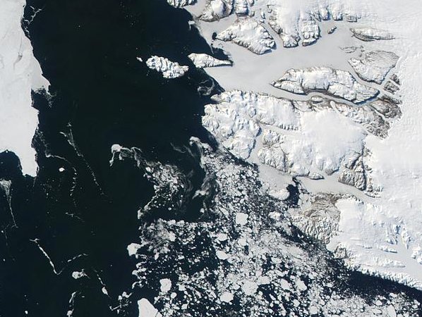
This MODIS (see footnote) satellite image was taken in May 2001 towards the north of Baffin Bay, between Canada and Greenland. Note the mountains of Greenland to the right and the large areas of solid sea ice to the north. To the south the sea ice is broken into large floes. These were dangerous waters for the Peterhead whalers because their ships could easily be damaged as they navigated through the ice fields. To make matters worse, when the wind was from the west the ice would close up and whole fleets of ships could be trapped for months on end. Footnote: The MODIS (or Moderate Resolution Imaging Spectroradiometer) is a key instrument aboard the Terra (EOS AM) and Aqua (EOS PM) satellites. Terra's orbit around the Earth is timed so that it passes from north to south across the equator in the morning, while Aqua passes south to north over the equator in the afternoon. Terra MODIS and Aqua MODIS are viewing the entire Earth's surface every 1 to 2 days, acquiring data in 36 spectral bands, or groups of wavelengths. These data are designed to improve our understanding of global dynamics and processes occurring on the land, in the oceans, and in the lower atmosphere. |
| Martyn Gorman · University of Aberdeen · Department of Zoology · © 2002 |