| The Greenland Sea whaling area. |
|
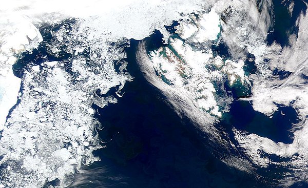
The cold, productive waters of the Greenland Sea are revealed in this SeaWiFS (Sea-viewing Wide Field-of-view Sensor) image. Greenland lies to the left and Svalbard (Spitzbergen) to the right of centre and towards the top. The image was taken in late July in the year 2000 by which time the sea ice had retreated to the north of Spizbergen. The Peterhead whalers exploited whales in the relatively safe open waters along the edges of the sea ice but by July the whales were widely dispersed and difficult to find, let alone to catch. The time had come for the ships to head home with their cargoes of blubber and bone, reaching Peterhead in late July or August. |
| Martyn Gorman · University of Aberdeen · Department of Zoology · © 2002 |