The auxiliary fort at Fendoch stood at the mouth of the Sma’ Glen, one of the passes into the Highland massif. From early times this route has seen the movement of livestock to and from the upland summer pastures, and during the eighteenth century it was used by drovers bringing black Highland cattle to the Lowland markets. One of the fort’s functions may have been to control movement of this kind. It was also one of the chain of forts, pivoted on the legionary fortress at Inchtuthil, which blocked the passes along the Highland line in the late first century.
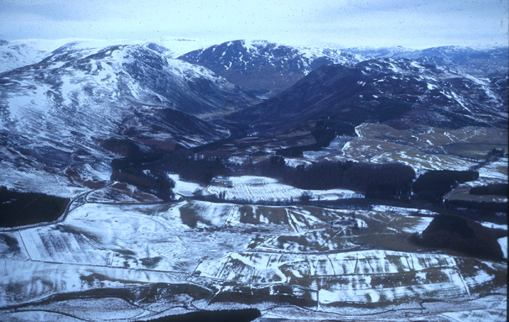
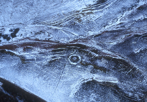
Aerial view of Fendoch and the Sma' Glen
from the south. The fort stood on the low plateau in the right foreground.
© Colin Martin
Although antiquaries had identified a Roman fort here in the eighteenth
century, its exact location was not established in modern times until
1936, when Ian (later Sir Ian) Richmond began excavating it. The defences
and gates were first identified. Then Richmond removed the topsoil in
a series of narrow trenches to reveal the slots cut into the subsoil for
Roman timber buildings. By ‘joining up the dots’ he was then
able to postulate the interior plan of the fort. Its central range consisted
of a headquarters building flanked by the commander’s house and
a pair of granaries. Behind these buildings was an aisled hall identified
as a hospital, and smaller structures which may have been workshops or
sheds. To the front and back of the central range were ten long buildings
identified as barrack blocks, each holding a century of troops. On this
basis Richmond identified Fendoch as a fort for a cohors milliaria
- that is, an infantry regiment of auxiliary soldiers nominally 1000-strong.
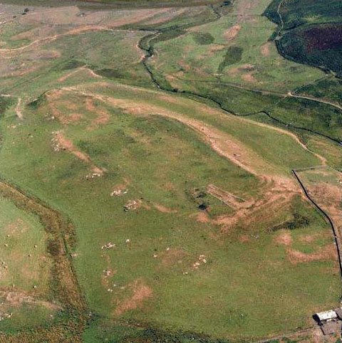
Aerial view of the fort.
Its playing-card shape, picked out by parching, can be made out on top
of the plateau. Traces of the ditches appear at the right hand corner.
© SCRAN/RCAHMS
Recently the reliability of Fendoch’s reconstructed plan has been
called into question. This follows the total excavation of an auxiliary
fort at Elginhaugh, near Dalkeith. The buildings there proved to be far
less regular than the ‘joining the dots’ technique applied
to other forts, including Fendoch, had suggested. Their functions, moreover,
were less obvious, especially in the case of the long buildings usually
identified as barracks. Nevertheless it seems certain that Fendoch was
the base of an auxiliary regiment, even though its internal accommodation
may not have been entirely as the published plan suggests.
Finds of pottery and other objects indicated that the fort had been built in the late first century, and occupied only briefly before it was abandoned. This pattern closely reflects that noted at the legionary fortress at Inchtuthil, and suggests that Fendoch was part of the scheme to garrison the edge of the Highlands following Agricola’s conquests of the early 80s and the battle of Mons Graupius. In the wake of the withdrawal of the Second Adiutrix legion from Britain in or shortly after 86 the Roman army abandoned these northern bases and, in a phased withdrawal over nearly 20 years, fell back to the Tyne-Solway line.
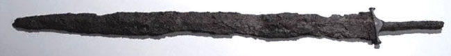
© SCRAN/National Museums of Scotland
Among the finds was an iron sword (above) of the type used by auxiliary
soldiers, which was found in a demolition trench. There is no direct evidence
of the unit which garrisoned Fendoch, but it may have been one of the
cohorts of Batavians and Tungrians which, according to Tacitus, bore the
brunt of the fighting at Mons Graupius. Perhaps this very sword was used
in the battle.
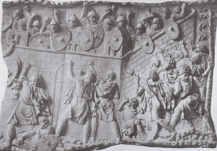
Scene from Trajan's Column, showing Roman
auxiliary soldiers defending their fort from an attack by Dacian warriors.
© Author's collection
A short distance from the fort, further into the mouth of the glen, stands a small circular earthwork which, it has been suggested, may mark the site of a Roman watch tower. It has not yet been confirmed by excavation. But the site is badly placed to observe intruders approaching the fort, so it was probably not, as has sometimes been suggested, an advanced post to give warning of attack. However it enjoys an unimpeded view from one side of the glen to the other, and no one could have entered or exited the pass without being seen by its occupants. It may therefore have been connected not with defence but with the control of movement - a function characteristic of early Roman frontiers.
Aerial photograph of a small watch tower
at the mouth of the Sma' Glen, Perthshire.
© Colin Martin